Ancient Syia: what is left of the town
Across the river from the village lie the ruins of the Roman town that gave Sougia its name.
Most people who come to Sougia know the beach, the tavernas and the church with the mosaic floor. Fewer know that the ancient town lay mostly on the other side of the river. What remains of it today are ruins, but they show how large Syia once was.
East of the river
The ancient town stood mainly on the east bank of the Sougianos. The remains found there include domed cisterns, houses and large buildings, dated from the first century BC to the sixth century AD.
The Tholoi, the Roman baths
The largest ruin is a Roman bath building known as the Tholoi, the domes. It covers about 3,000 square metres, and its walls survive to a height of 3.5 to 4 metres. Six of its rooms were roofed with domes.
The water came from the aqueduct. It filled the cisterns, and from there it reached the houses and these baths.
How the water came down to Syia: The water of Syia
The tombs on the hill
The town’s cemetery lay at the western edge of the eastern hills. Its tombs are vaulted and built of river pebbles held in mortar. Each has a single chamber, with its entrance on the west side. They are the same type as the tombs at Lissos, the other harbour of Elyros.
Walk to the other harbour: Lissos, the walk, the theatre, the boat back
West of the river: the village
The modern village stands on the west bank. Here the old town survives only in pieces: fragments of ancient stone reused in later buildings, and marble inscriptions set into the walls of houses.
On the hill west of the village, near the spring and the small church of Agia Irini from the early fourteenth century, there may have been another part of Syia, either houses or a sanctuary. No one knows for certain.
The chapel is about 1.4 km from the village, some forty minutes on foot along the marked path.
What you can see easily
The baths, the cisterns and the tombs east of the river are ruins. The easiest traces of Syia to see are in and around the village.
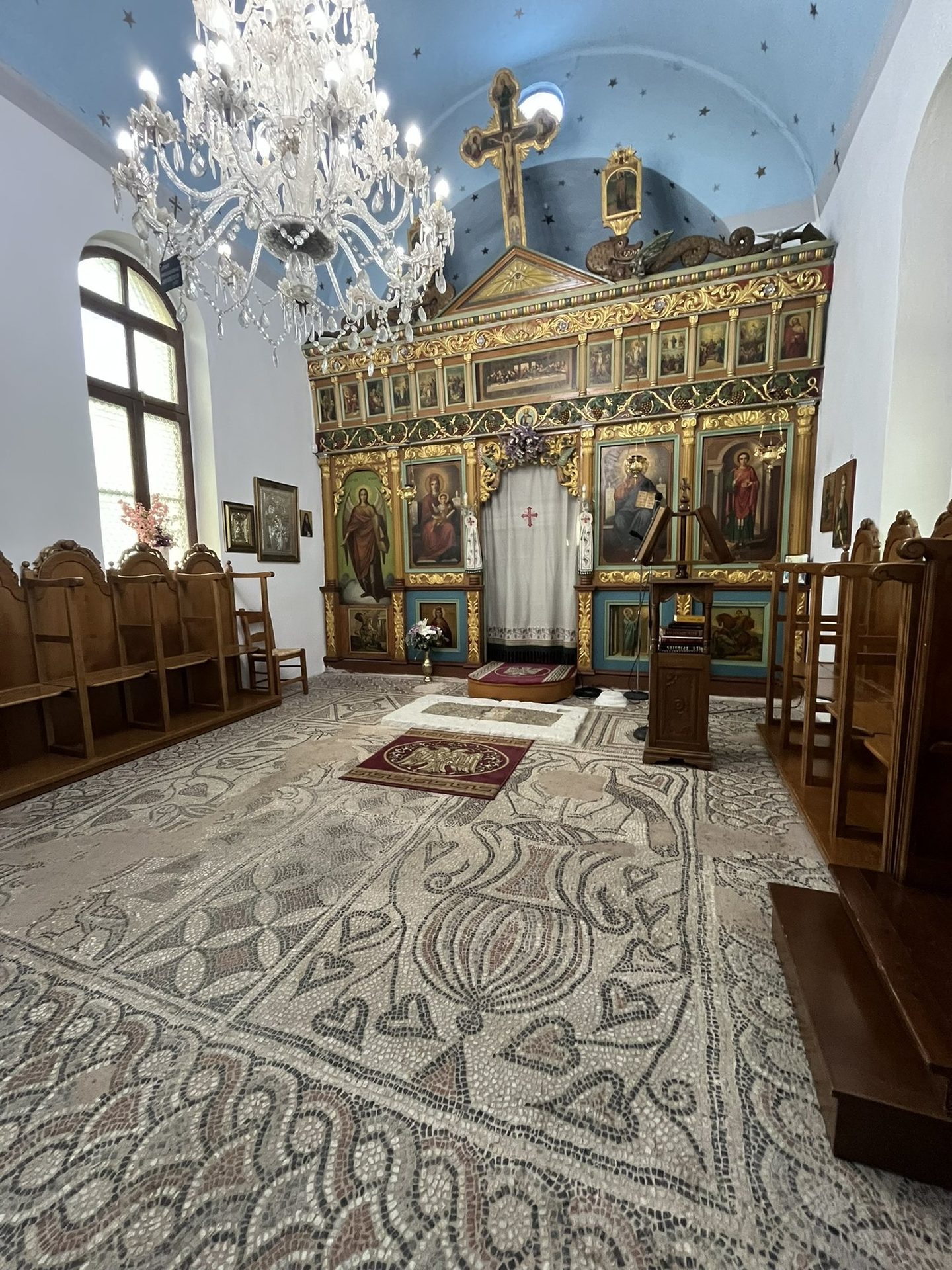
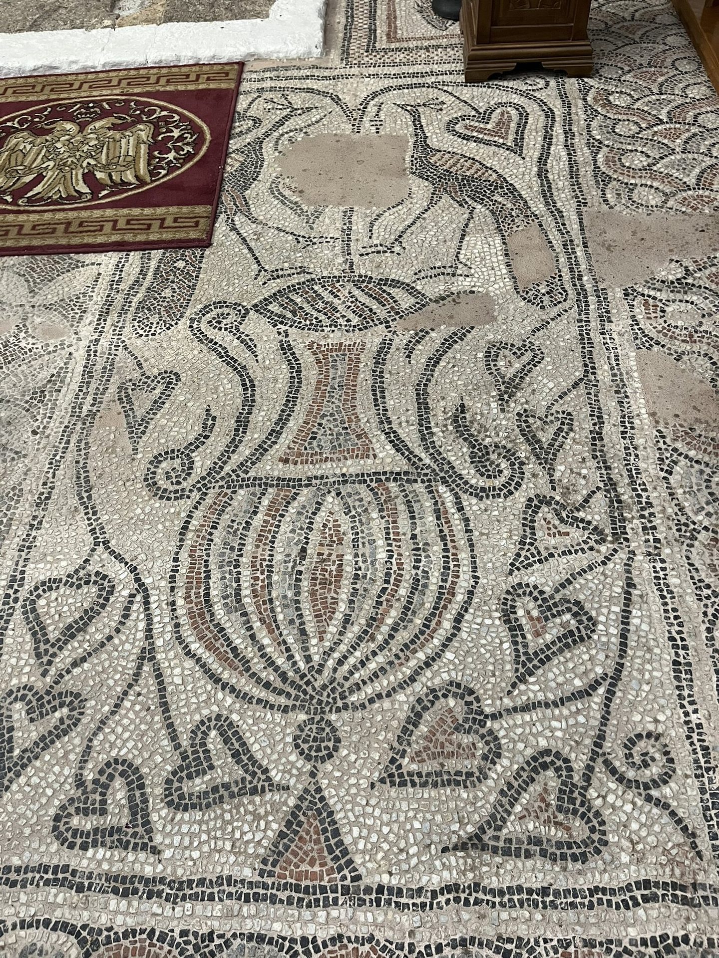
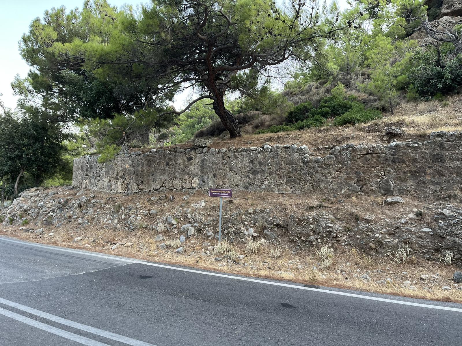
The mosaic floor of one of its basilicas is now the floor of the church of Saint Panteleimon, in the middle of the village. A stretch of the aqueduct wall stands beside the road to Moni, about ten minutes’ walk past the last houses. And in the village centre, by the Roxanne café, an information board tells the story of ancient Syia.
The harbour, the earthquake and the mosaic: Syia, Lissos, Elyros: the old cities under the pebbles
Questions walkers ask
Where was ancient Syia?
Mostly on the east bank of the river at Sougia, with its cemetery on the eastern hills. The modern village stands on the west bank.
What can you see of ancient Syia today?
The mosaic floor in the church of Saint Panteleimon and part of the aqueduct wall on the road to Moni are easy to see. The Roman baths, the cisterns and the tombs east of the river survive as ruins.
Why is it called Sougia?
The name goes back to ancient Syia, from σῦς, the Greek word for pig. The town was known for its pigs, and over the centuries Syia became Sougia.
Sources
- Chania Trails signposts and map board, Sougia beach, by Lotos café
- Information board “Ancient Syia”, village centre of Sougia, by Roxanne café
- Syia, Wikipedia
Last checked October 2026. Times, prices and opening seasons change. Please check before you travel.