Syia, Lissos, Elyros: the old cities under the pebbles
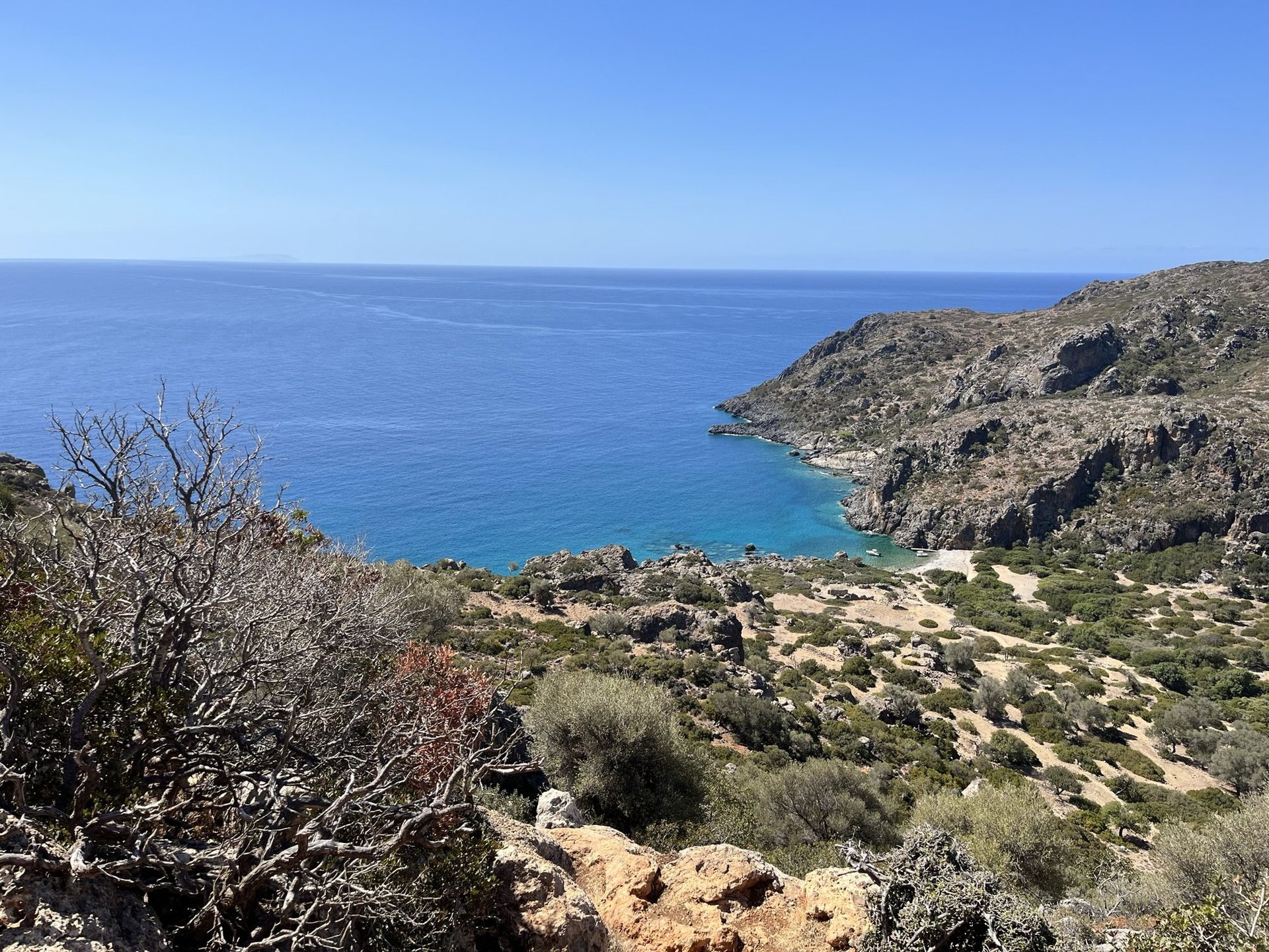
Before it was a quiet village, Sougia was the harbour of the most powerful city in south-west Crete.
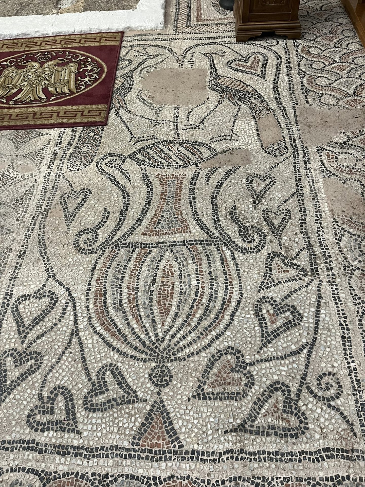
In the village church of Sougia, people stand during the liturgy on a floor laid fifteen hundred years ago. Two peacocks face each other over an amphora, and ivy curls around them. It is easy to walk past this church. Don’t.
Elyros, the city on the hill
On a hill called Kefala, near the village of Rodovani above Sougia, lie the remains of Elyros. In Hellenistic and Roman times it was the leading city of south-west Crete, and later the seat of a bishop. Today it is unsigned and overgrown: a Roman cistern, some walls, and a view.
Syia, the harbour
Elyros had two harbours. One was Lissos, along the coast to the west. The other was Syia, today’s Sougia, where the Sougianos river, also called the Kamarianos, reaches the sea. It was a wide, sheltered harbour. Syia served as a port from Hellenistic times, but it was never an independent city. It grew in the Roman period, and in early Byzantine times it was still a small provincial town that lived from trade, thanks to its harbour and its rich supply of timber. It probably lasted until around the sixth century, before it was destroyed by Saracen raids.
The name comes from σῦς, the ancient Greek word for pig: Syia was known for its pigs, and Sougia is the old name, worn down over the centuries. A sailing guide to the coast from Roman times, the Stadiasmus of the third century AD, calls it Syva and places it six stadia west of Poikilassos, on Cape Trypiti. In the sixth century Stephanus of Byzantium describes it as the port of Elyros.
Walk to the other harbour: Lissos, the walk, the theatre, the boat back
In the nineteenth century the English traveller Robert Pashley still saw its aqueduct, its walls, its tombs and the remains of three early Christian basilicas.
Archaeologists have since identified four early Christian basilicas in Sougia. Two of them, known as B and C, lie east of the river. The other two, A and D, stand at the west end of the village.
What is left of the town itself: Ancient Syia, the ruins across the river
The water of Syia
Syia took its water from a spring at Agios Pavlos, north of Elyros. A channel brought it some 8 km down to the town: about 490 m³ a day, enough for around 2,500 people.
The channel was built of masonry, lined with hydraulic mortar and carried on a stone wall 1.5 to 2 metres high. Where it had to cross a ravine, it ran over a water-bridge, and there were four of them. The first remains appear near Moni, 3.2 km from the village. The provincial road now cuts through the line, and on the east bank of the river the wall still stands 5 metres high.
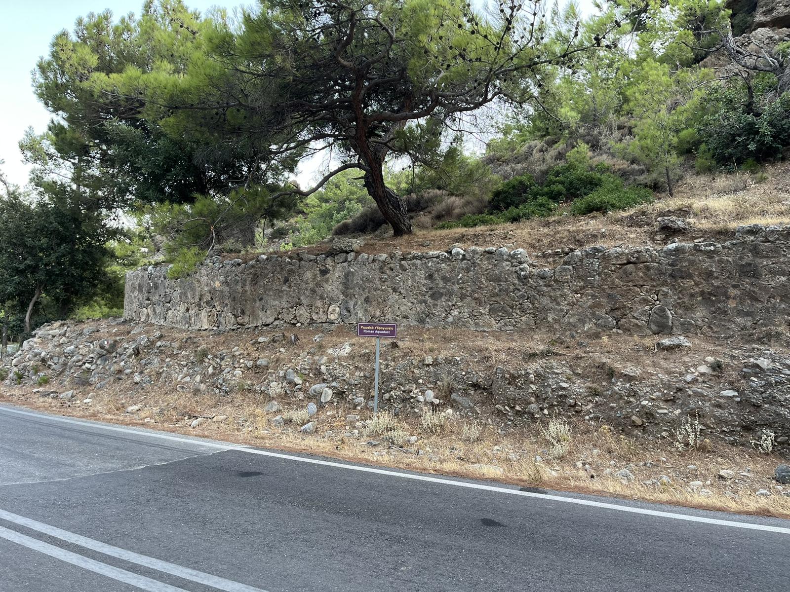
No distribution works have been found in the town itself. The water fed cisterns, which supplied the houses and the Roman baths.
You can still see part of it today. Walk out of Sougia on the road towards Moni, and about ten minutes past the last houses the old wall stands beside the road.
The day the island moved
On 21 July in the year 365, a great earthquake struck the eastern Mediterranean. It lifted western Crete by up to nine metres. At Phalasarna, on the west coast, the ancient harbour now lies about seven metres above the sea. The tsunami that followed reached as far as Alexandria.
At Sougia the coast rose by about six metres. That is why the remains of Syia’s harbour have to be looked for on dry land today, possibly at the east end of the seafront.
The floor of Saint Panteleimon
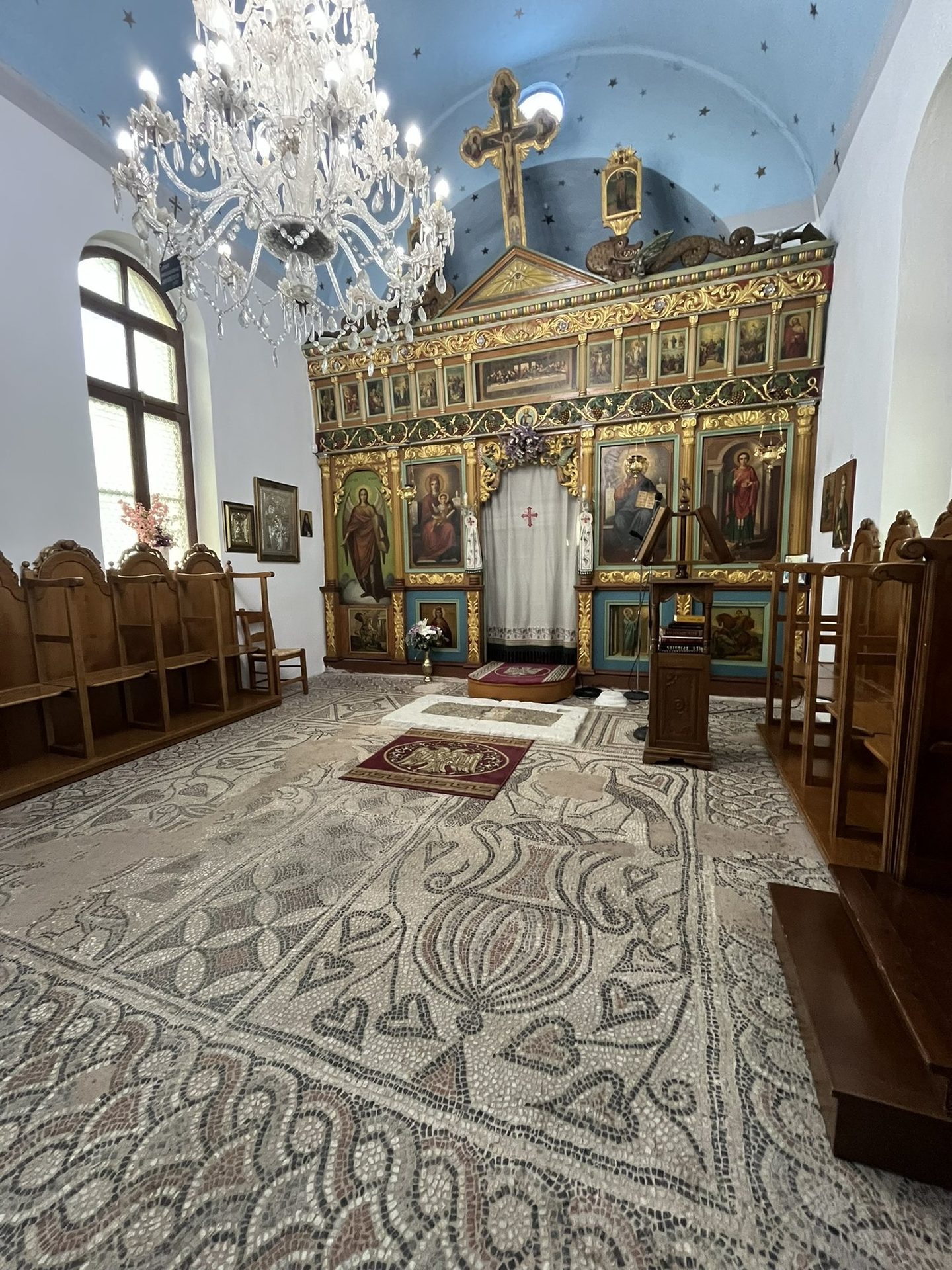
The church of Saint Panteleimon stands over one of Syia’s basilicas, known as Basilica A: a three-aisled church from the middle of the sixth century, excavated by the archaeologist A. Orlandos in the 1950s. Its mosaic, in the central aisle and the narthex, is attributed to a workshop of the sixth century. It shows peacocks, a deer, a fish, amphorae wound with ivy and circles of geometric pattern. In early Christian art the peacock stood for eternal life. Greek inscriptions on two of the old columns call on Saint Panteleimon, the healer, and Saint Demetrios. A column capital carved with doves, found here, is now in the Byzantine and Post-Byzantine Collection of Chania.
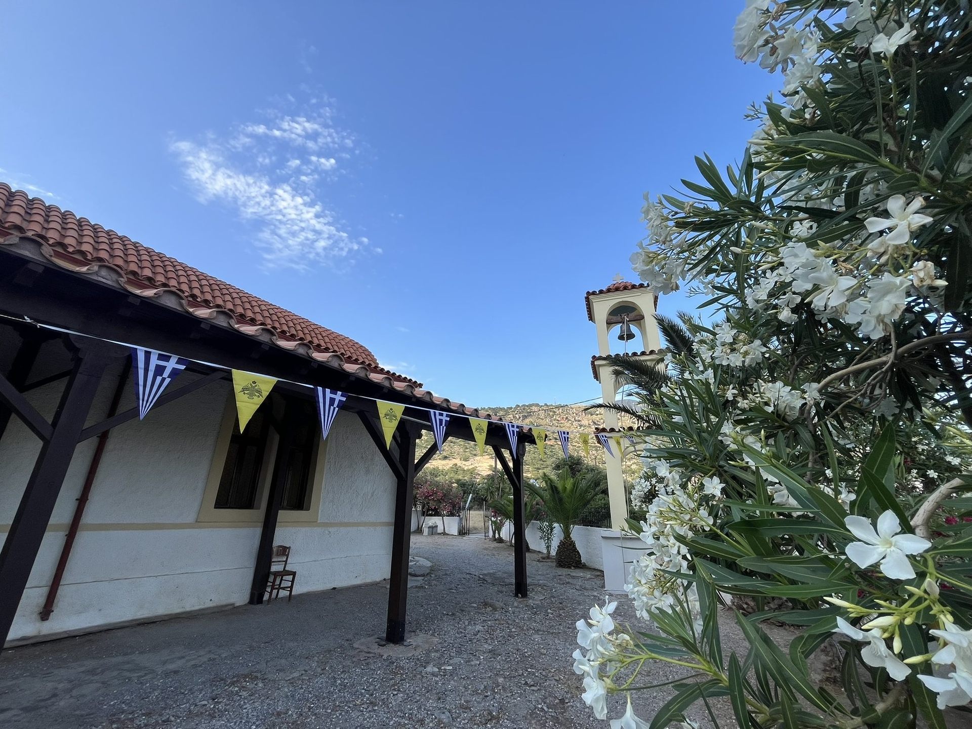
The church you see today is much younger and plainer, white outside, with a blue ceiling painted with stars inside.
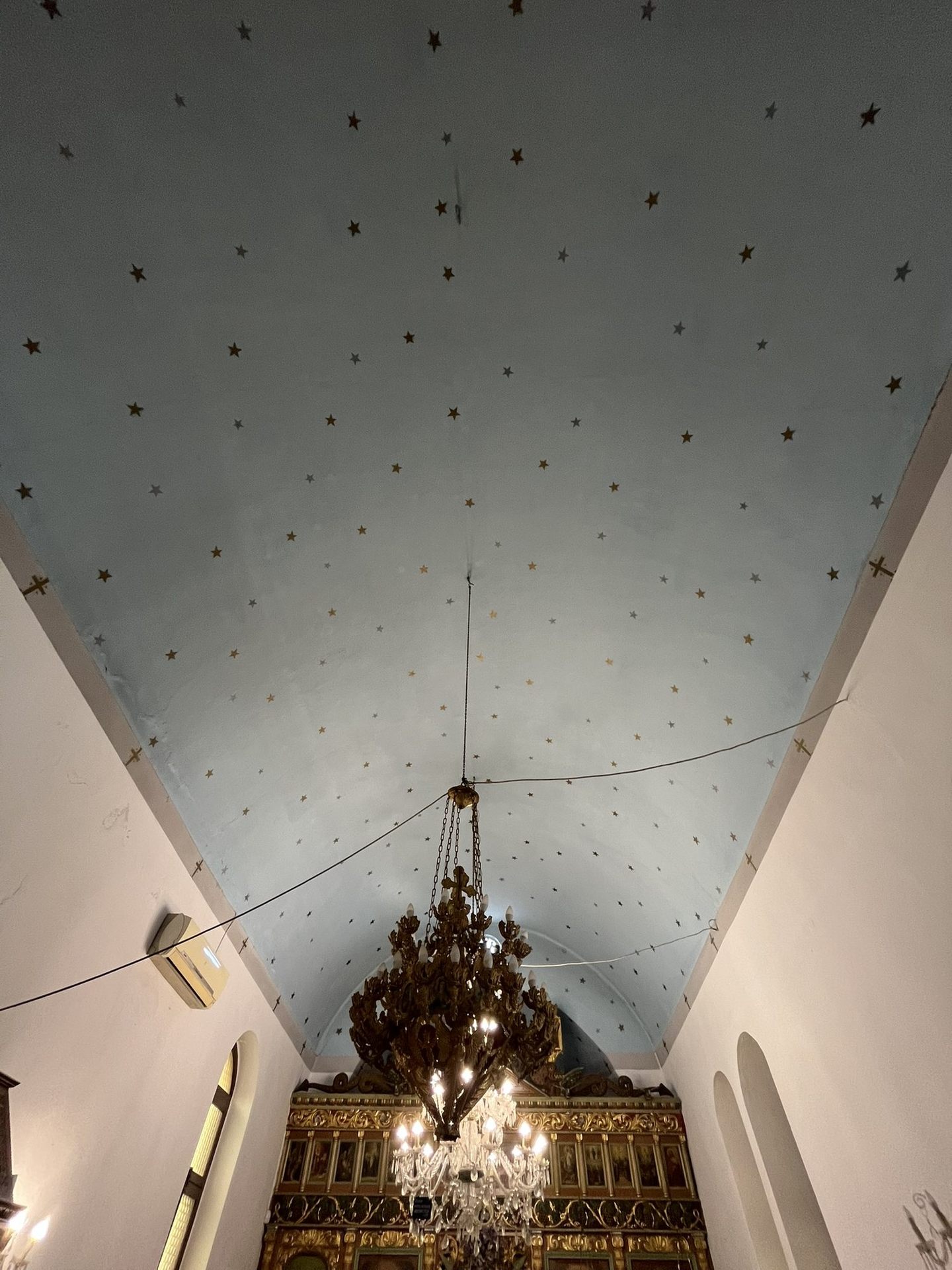
If the church is locked, ask us at AVYSSOS and we will arrange for it to be opened.
These stories are woven into our Hunt for Elyros, a game on foot through the village for our guests. It launches when we open.
Questions walkers ask
Can you see the mosaic in Sougia?
Yes. It is the floor of the church of Saint Panteleimon, in the middle of the village. If the church is locked, ask us and we will arrange for it to be opened.
What was Sougia called in antiquity?
Syia. It was one of the two harbours of Elyros, the leading city of south-west Crete in Roman times.
Why is it called Sougia?
The name goes back to ancient Syia, from σῦς, the Greek word for pig. The town was known for its pigs, and over the centuries Syia became Sougia.
Sources
- Chania Trails signposts and map board, Sougia beach, by Lotos café
- Information board “Ancient Syia”, village centre of Sougia, by Roxanne café
- Information board “Basilica A”, church of Saint Panteleimon, Sougia
- Syia, Wikipedia
- Saint Panteleimon basilica, cretanbeaches.com
- Ancient Elyros, meetcrete.com
- Lissus (Crete), Wikipedia
- Inscriptions in the basilica of Sougia, Cult of Saints, Oxford
- 21 July 365, day of horror in the Mediterranean, GFZ
Last checked October 2026. Times, prices and opening seasons change. Please check before you travel.